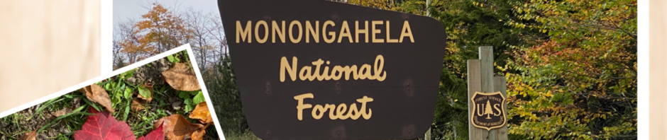
Wild, Wonderful, West Virginia. Marilee was born there and I got there as soon as I could. Before we met way back in 1969, she had traveled many parts of the state with her family. My step-dad and I rode our motorcycles hundreds of miles on U.S. Routes throughout the central and northeastern part of the state. But now Marilee and I were exploring a portion of the Monongahela National Forest that neither of us had experienced before.
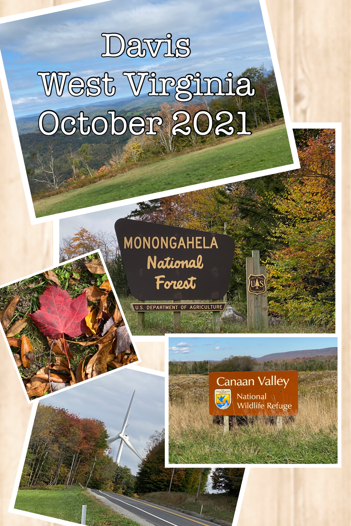
9 – 10 Oct 2021 Travel and Close In Plans.
Arrival day and a planning day. Relaxing for the day just because we could, we pulled out a paper map and did some basic research regarding the territory we intended to visit. If you’re inclined to explore a bit of West Virginia geography, here are the boundaries we set for ourselves [County (Main city)]:
Counties of : Tucker (Davis); Randolph (Elkins); Upshur; (Buckhannon); Lewis (Weston); Taylor (Grafton); Harrison (Clarksburg/Bridgport); Barbour (Philippi).
10 Oct 2021 — Canaan Valley Wildlife Refuge.
One of the discoveries during our research was a nearby wildlife refuge. Near enough to hike and not be late for dinner, we set out explore its trails.
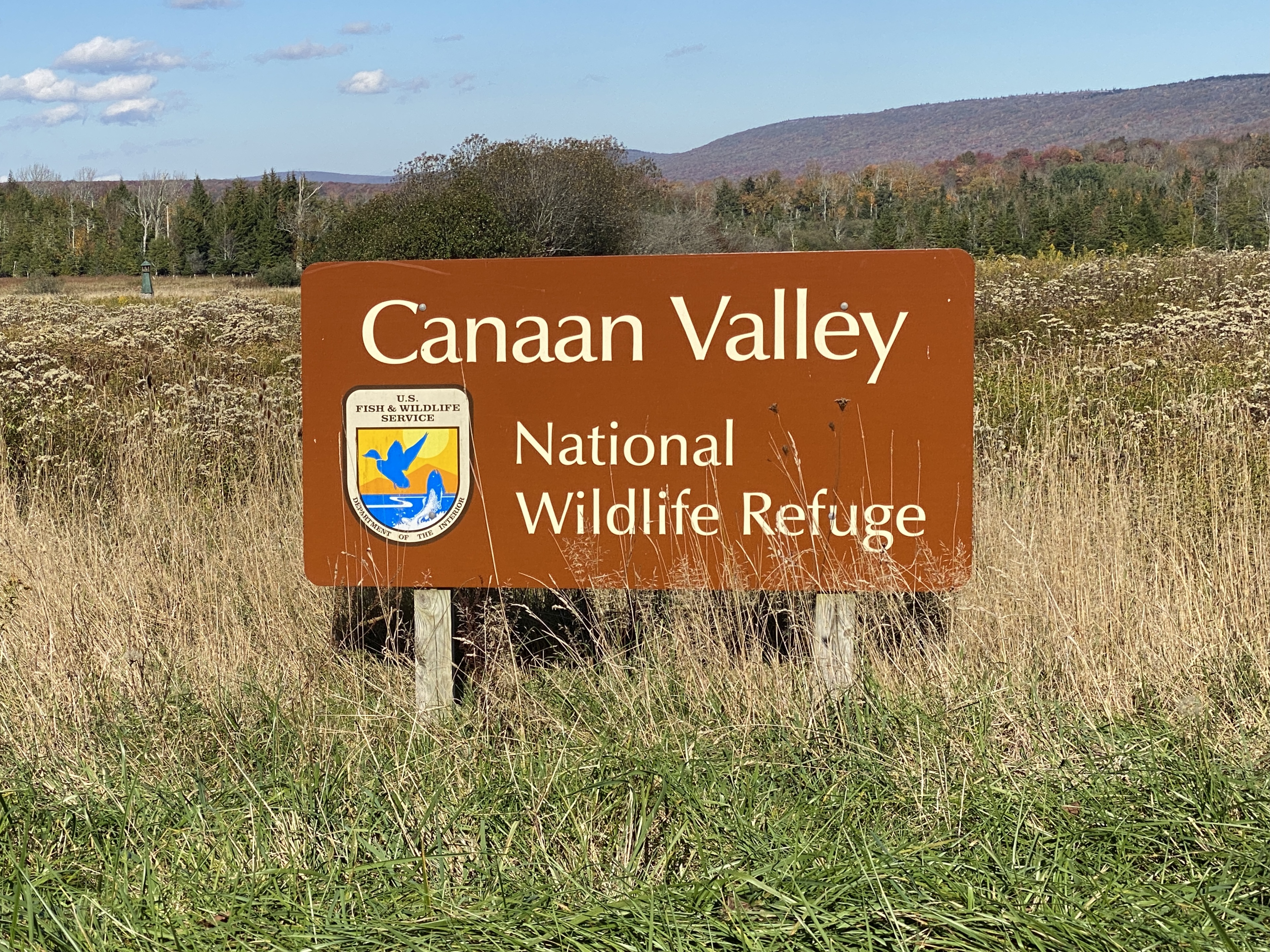
It turned into an impromptu hike of undetermined length. Probably not even a full mile. Nevertheless, the raised “trail” (actually a boardwalk) into the high wetlands of the area provided turnouts for observation. We documented a 30 minute observation of heard wildlife (as in listening with one’s ears). Visuals were fleeting glimpses of tiny birds (still not identified), grasshoppers, and evidence of fox, beaver, or groundhog (paw-prints were not photographed).

11 Oct 2021 — Woolly Worm Sighting:
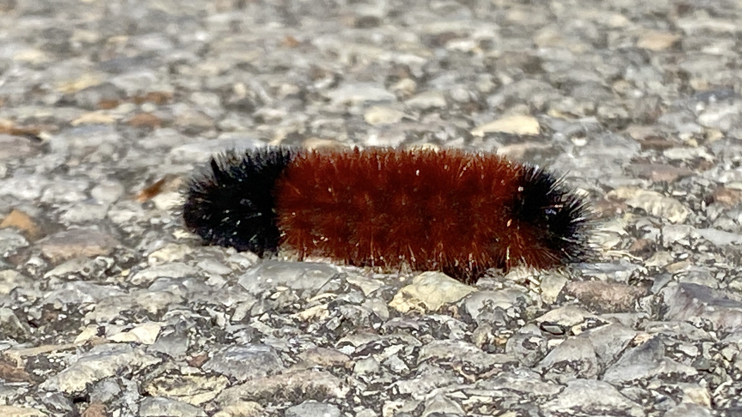
(This photograph constituted some serious planking manuveurs.)
According to woolly worm watchers, there are two generations of worms each year. The first appear in June and July, and the second in September. The second generation worms are the “weather prophets.
If the rusty band is wide, then it will be a mild winter. The more black there is, the more severe the winter.
That’s it! Note that white, yellow, or other colors of fuzzy caterpillars are NOT the same type of woolly worm and are not used for weather forecasting. We’ll leave the weather-prognosticating “skills” to your own observation!
11 Oct 2021 — Blackwater Falls State Park, Davis, West Virginia.
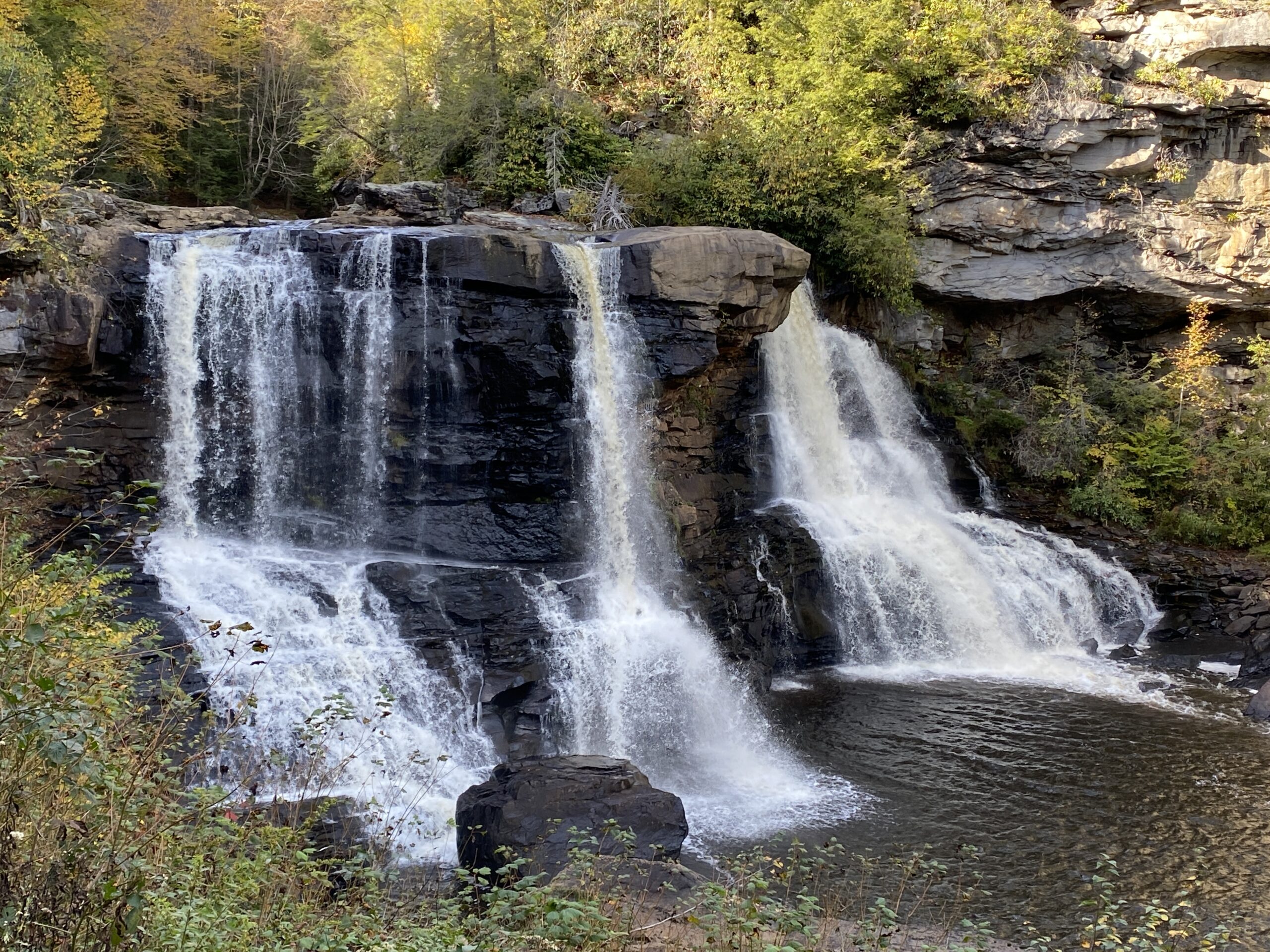
Today’s close in travel was a visit to Blackwater Falls in Davis, West Virginia. The trip to visit the platform facilitating this photo required about a 1/2 mile hike to the boardwalk stairway of over 200 steps and an unknown number “rest” platforms and three observation platforms.
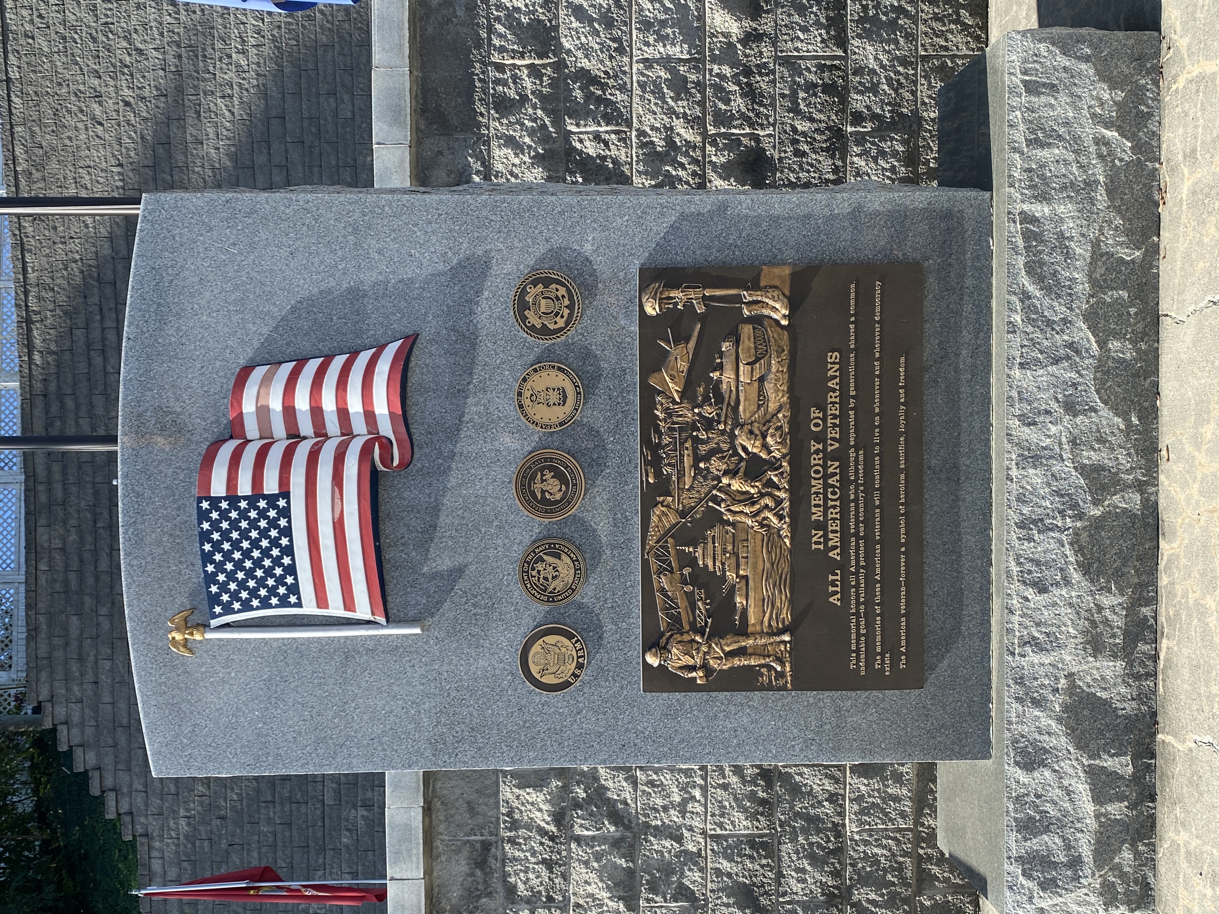
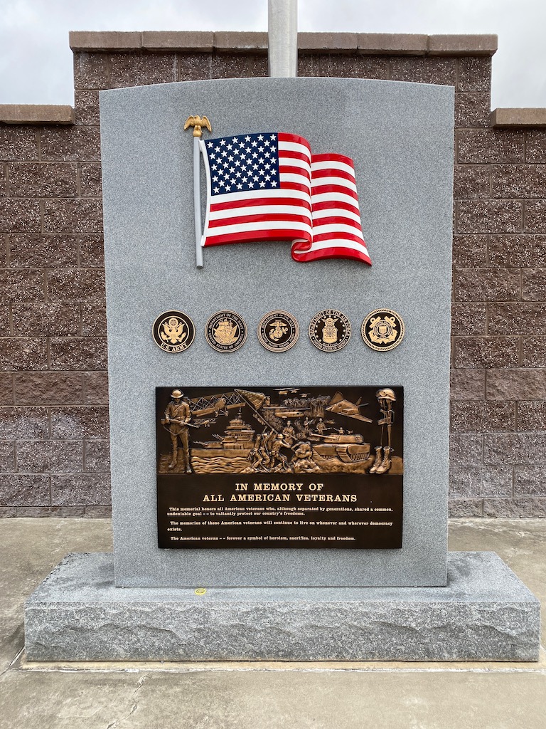
12 Oct 2021 — War Memorial, Parsons, West Virginia.
We visited a little known and remarkably well done veterans war memorial. Bas relief plaques depicted each era of war. The public accessible wall top bricks were engraved with county veterans names who were killed in action. It is a very moving memorial.

We also visited Michelle Rhodes (realtor) for future house hunting in WV. Counties listed above are the boundaries.
And then back to finding the trails at the wildlife refuge. The trail heads are obscure and not well marked.

The “You Are Here” sign wasn’t exactly helpful. We ventured in anyway but never wandered beyond a well beaten path or gravel road.
13 Oct 2021 — Seneca Cavarns, West Virginia.
A leisurely morning over coffee, conversation, and another short foray into the local wildlife refuge attempting to decipher the cryptic trail head markers. Results remain inconclusive.
The afternoon was spent finding our way to Seneca Rock & Spruce Knob Recreational Area. It is a vast swath of forest and includes the cavarns AND the highest point in West Virginia.
We visited the gift shop and got the brief on what we would encounter going down into the cavarns. After hearing about the environment, I decided this was as far as I needed to go:
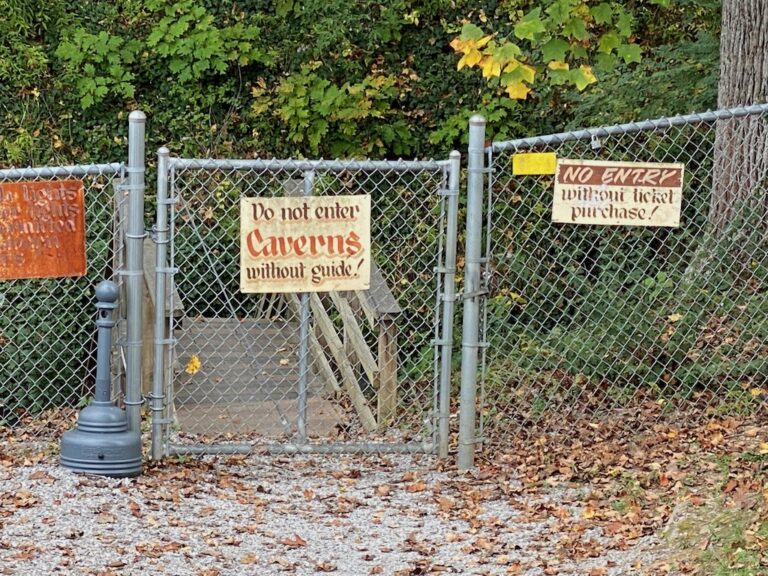
Yeah, I never even bothered to buy a ticket. But it was an informed decision. The postcards tell as much as I need to know about the underground attraction. And it was a really nice drive.
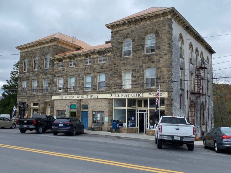
14 Oct 2021 — Davis, West Virginia.
The morning was taken up with a quick trip to the local grocery store for a few food items. We stopped to photograph an old building and the war memorial at Davis.
The big event of the day was horseback riding. The owner of the nearby Mountain Trail Rides guided Marilee on a one hour tour along a low mountain trail.
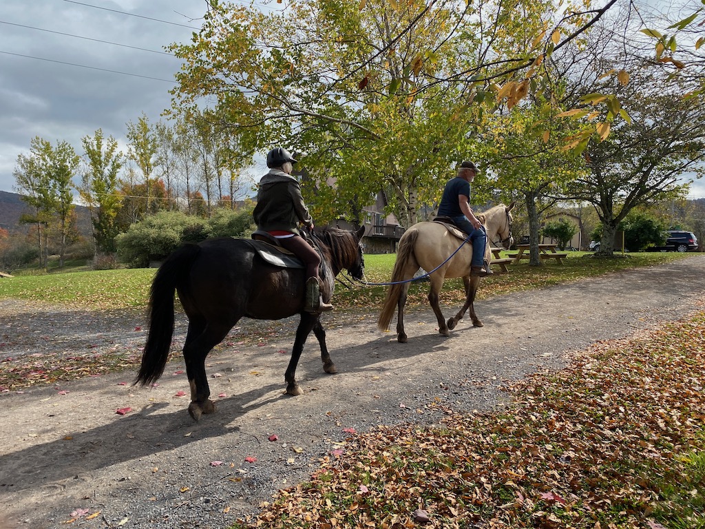
Marilee reported that Milton did a fine job of describing the trail and various sights along the way.
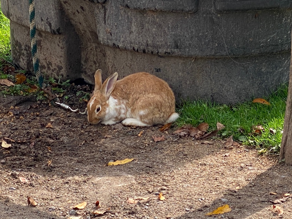
Whlie Marilee toured the trail, I toured the barnyard and visited with one of the locals seen here:
15 Oct 2021 — Spruce Knob, West Virginia.
Up at dawn, breakfast finished, dishes done, and out the door for the final day-trip of this week long West Virginia excursion.
This first stop along the way was the U.S. Forest Service Visitors Center. There we picked up some literature about the trails we’d find there and then off we went.
The maps looked informative but when the cell-signal-dependent GPS stopped processing, we discovered the maps had no useable detail to find our way to our destination. Arrgh!!!
Nevertheless, with just a modicum of directional awareness and some degree of persistance we found our way to the summit. (Well, okay. We picked up some signal too.)
Signage at the site was clear and concise:
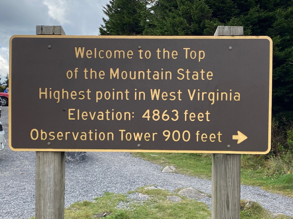
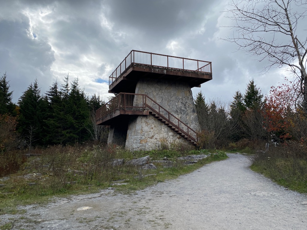
Our efforts yielded this:
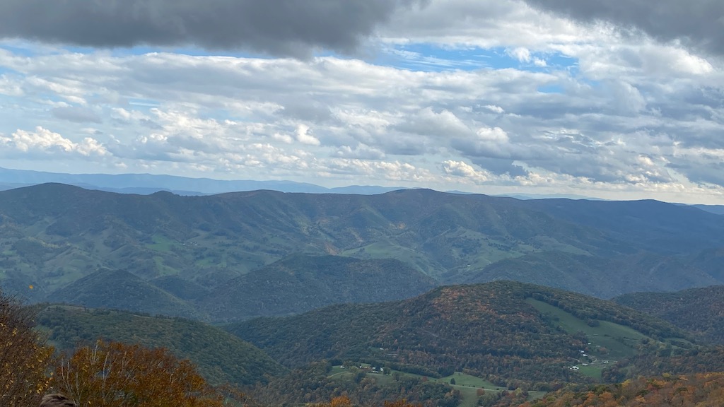
The vista was taken from a hiking trail around the base of the observation tower which was erected in 1968. The trees around the tower have grown since then and the best view is now from the trail rather than the tower.
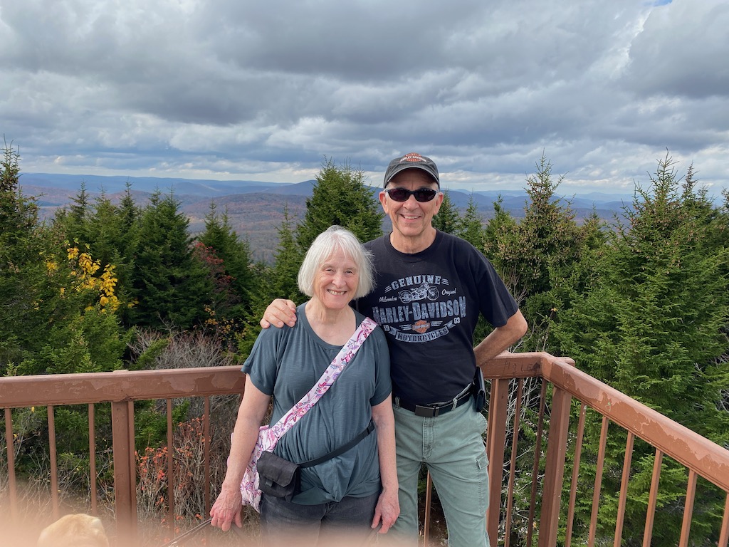
Nevertheless, the view from the tower is satisfactory. And if Marilee and I were not standing in the way, a viewer of this photo would be able see more of the spruce trees behind us. Yes. Only spruce trees. If one really cares to see the panoramic view of the unfolding valley below, one only need to hike another 900 feet south on the trail for that viewing experience.
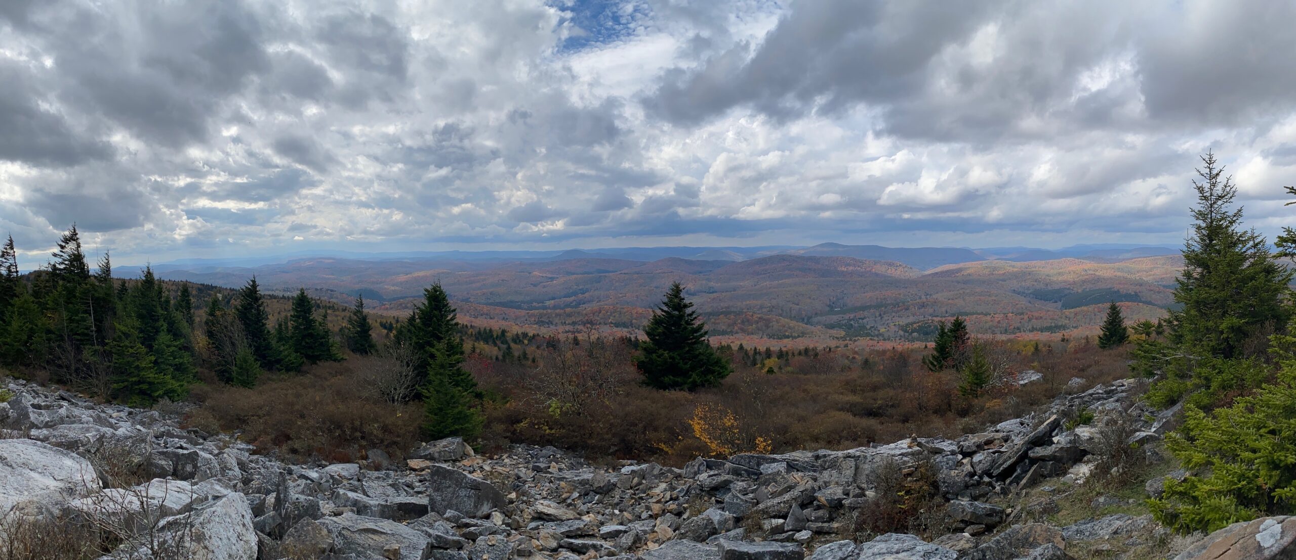
Indeed, march down the steps and make a lefthand turn. Just a short distance further south on the well marked trail yields the following most excellent panoramic view of the low mountains on the western edge of the Appalachian range.
And that is how we spent our fall vacation in 2021.
Hi Ed, Thank you for the photo tour of West Virginia…funny, but whenever I describe how good my reception is with Verizon service, I always say: I never lost a signal on the road ANYwhere… Except in West Virginia 😂😂😂… loved the War Memorial and the final vista… I would have enjoyed the entire week myself!
Sooo good to catch up last night… my love to you and Marilee… hope to see you SOON! 😎